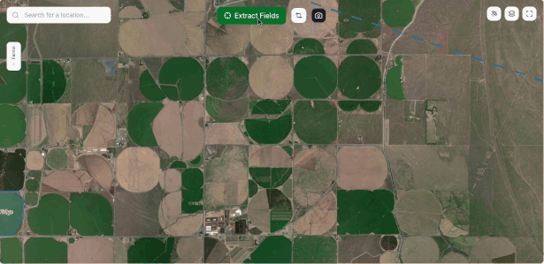
AI-Powered Field Boundary Mapping
Transform weeks of manual field delineation into seconds. Our AI extracts field boundaries from satellite imagery, giving you a fast head start on your mapping projects.
Pay-as-you-go • Export ready formats
Why Choose Autobounds?
Cutting-edge AI technology meets practical agriculture needs
Lightning Fast
What takes hours of manual work is completed in seconds. Point to a field or draw a simple hint and watch AI do the rest.
Simple & Intuitive
No complex software or training required. Point to a field, click, and get instant results. Perfect starting point for your mapping workflow.
Export Ready
Download industry-standard formats (GeoJSON, Shapefile) that work seamlessly with your existing GIS tools and workflows.
Crop Health Insights
Built-in NDVI analysis reveals crop health patterns from satellite data. Spot stressed areas and optimize resource allocation across large operations.
Built for Agriculture Professionals
Whether you're managing hundreds of acres or thousands, Autobounds scales with your operation
Farm Managers
Get a quick head start on field mapping for crop planning and initial area estimates. Perfect for preliminary assessments.
Ag Consultants
Speed up initial client proposals with rapid field identification. Great starting point before detailed GPS surveys.
Insurance Companies
Accelerate initial claim assessments with satellite-based field detection. Verify with ground truth for final determinations.
Research Organizations
Rapidly generate initial field datasets for research projects. Ideal for large-scale studies requiring quick field identification.
Equipment Dealers
Help customers get quick field size estimates for equipment planning. Supplement with ground measurements for final sizing.
GIS Professionals
Jumpstart mapping projects with rapid field detection from satellite imagery. Refine with survey data as needed.
Simple Process, Powerful Results
Point & Click
Draw a simple hint or click on a field. No complex tools or training required.
AI Processing
Our advanced computer vision AI analyzes satellite imagery and rapidly extracts field boundaries.
Export & Use
Download GeoJSON or Shapefile formats ready for your GIS, farm management, or analysis tools.
Works With Your Existing Tools
Export industry-standard formats that integrate seamlessly with popular agriculture and GIS platforms
John Deere Operations Center
Coming soon
Climate FieldView
Via export
ESRI ArcGIS
Shapefile compatible
QGIS & More
Standard formats
Trusted by Agriculture Professionals
Farm Manager
Midwest Corn Operation
"Game changer for managing hundreds of fields across multiple farms. What used to take weeks of manual digitizing now happens in minutes. Perfect for getting our entire operation mapped and organized fast."
Ag Consultant
Precision Agriculture Services
"Incredible for large-scale assessments. I can map entire regions in hours instead of days, giving clients instant visual context for our discussions. Transforms how fast we can scope and plan projects."
GIS Professional
Regional Mapping Firm
"Revolutionizes how we handle massive agricultural mapping contracts. Can digitize thousands of acres in a day instead of months. Clients get their field inventories immediately, and we can focus on higher-value analysis work."
Join hundreds of agriculture professionals saving time with AI-powered field mapping
Start for Free